
"Early warning system" project completed
A newly developed monitoring tool for agriculturally exploited soils enables detection of increased chemical inputs.
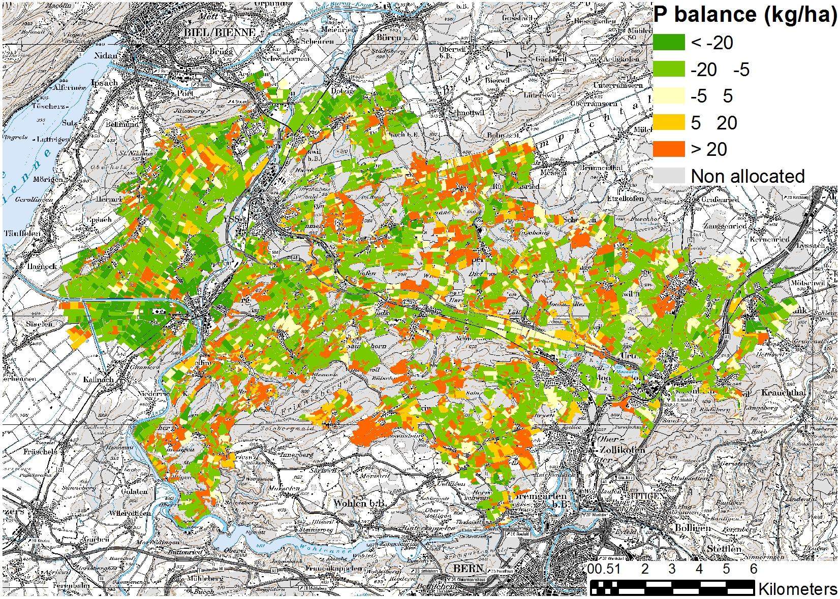
The regional monitoring tool provides spatially and temporally explicit maps for crop rotation, manure and mineral fertilisers and the associated nutrient and pollutant inputs in soils. The regional model allows agricultural and soil systems to be observed as an integrated whole in the context of a specific region. It aids early identification of non-sustainable developments within a region and facilitates the planning of preventive measures. Scenario analysis can, moreover, be used to sketch out suitable measures. The model also generates information for soil erosion simulation, humus assessment, soil biodiversity, or the quantification of greenhouse gases.
Thanks to the tool, the project creates a basis for effective soil protection, including agricultural environmental monitoring or agriculture-related environmental objectives. In a subsequent phase, the monitoring tool is to be used in collaboration with cantonal agriculture and soil agencies. Successful implementation will, however, be contingent on researchers being given prior access to geo-referenced cantonal data on agricultural usage.
- Early Warning System project
- Executive Stakeholder Summary (available in German or French only) (PDF)